Ozark Dome - Arkoma Basin - Ouachita Mountain Transect (ODABOuT)
This project is focused on research, 3D modeling, and regional geologic mapping in the “ODABOuT” area. Mark Hudson (USGS) is the project cheif.
As part of this project, I am actively developing a 3D framework model of the entire Ouachita orogenic system in eastern Oklahoma and western Arkansas, USA. I am also working on an orogen-scale 2D kinematic reconstruction and associated thermo-kinematic model.
Recent publication from this project:
see below for snippets!
Phase I

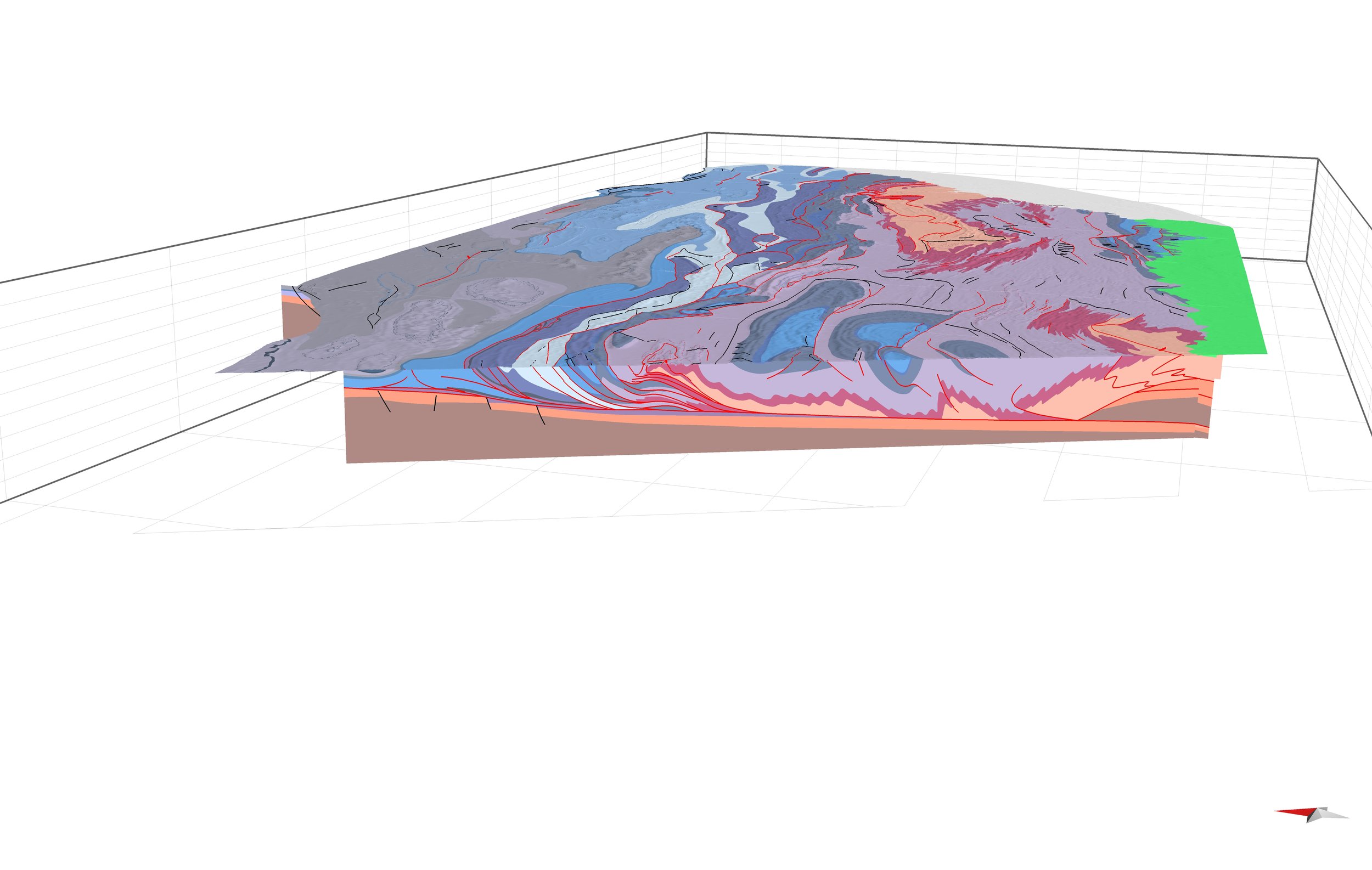
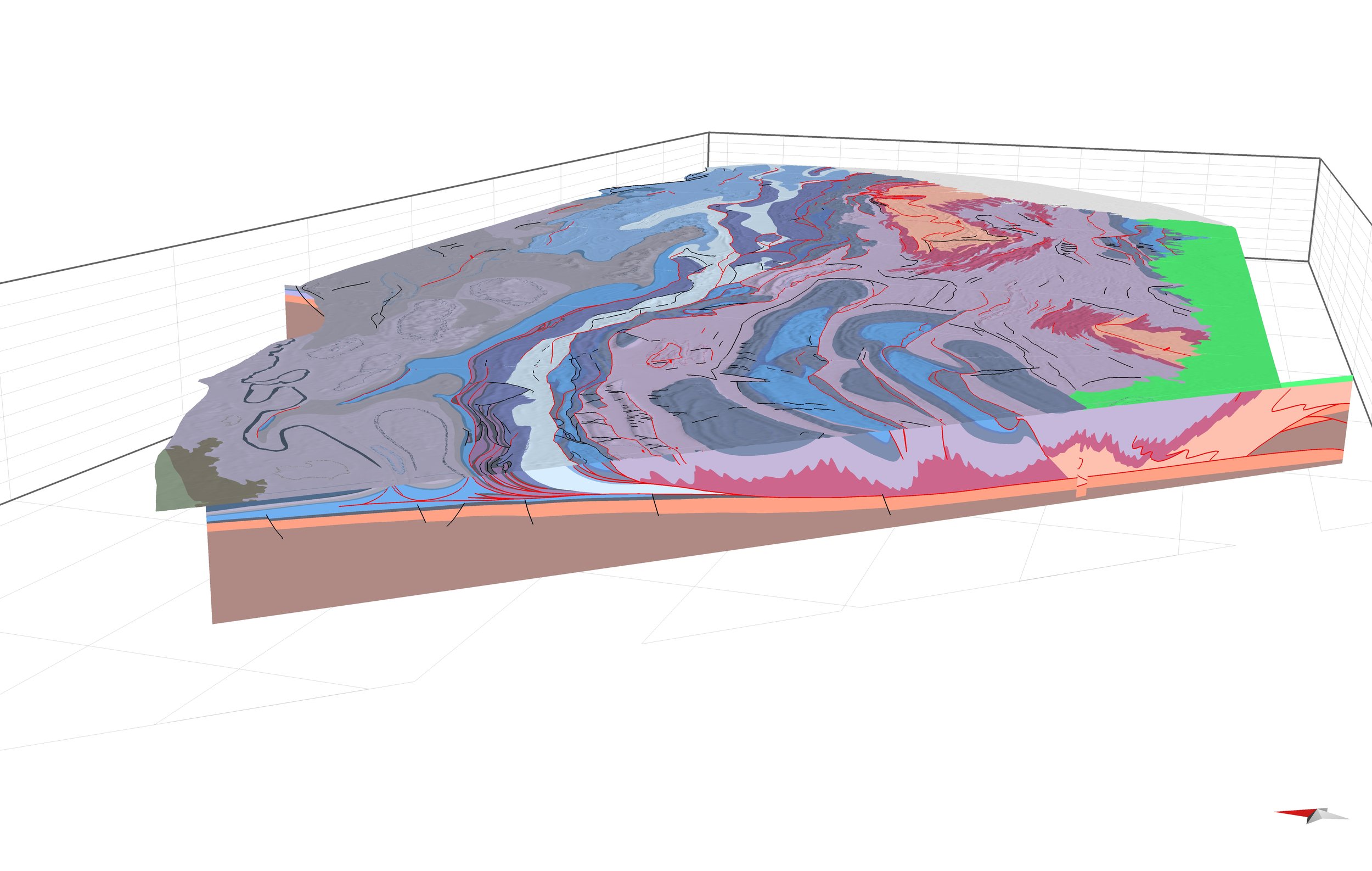
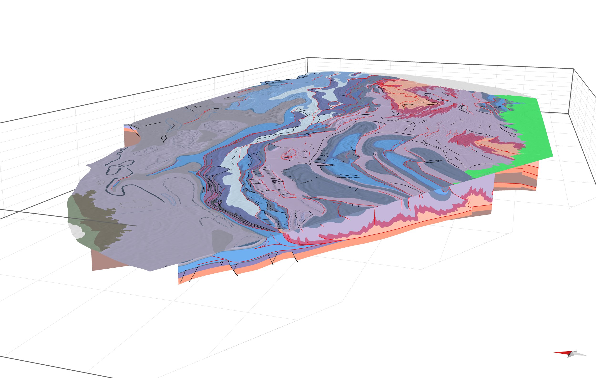
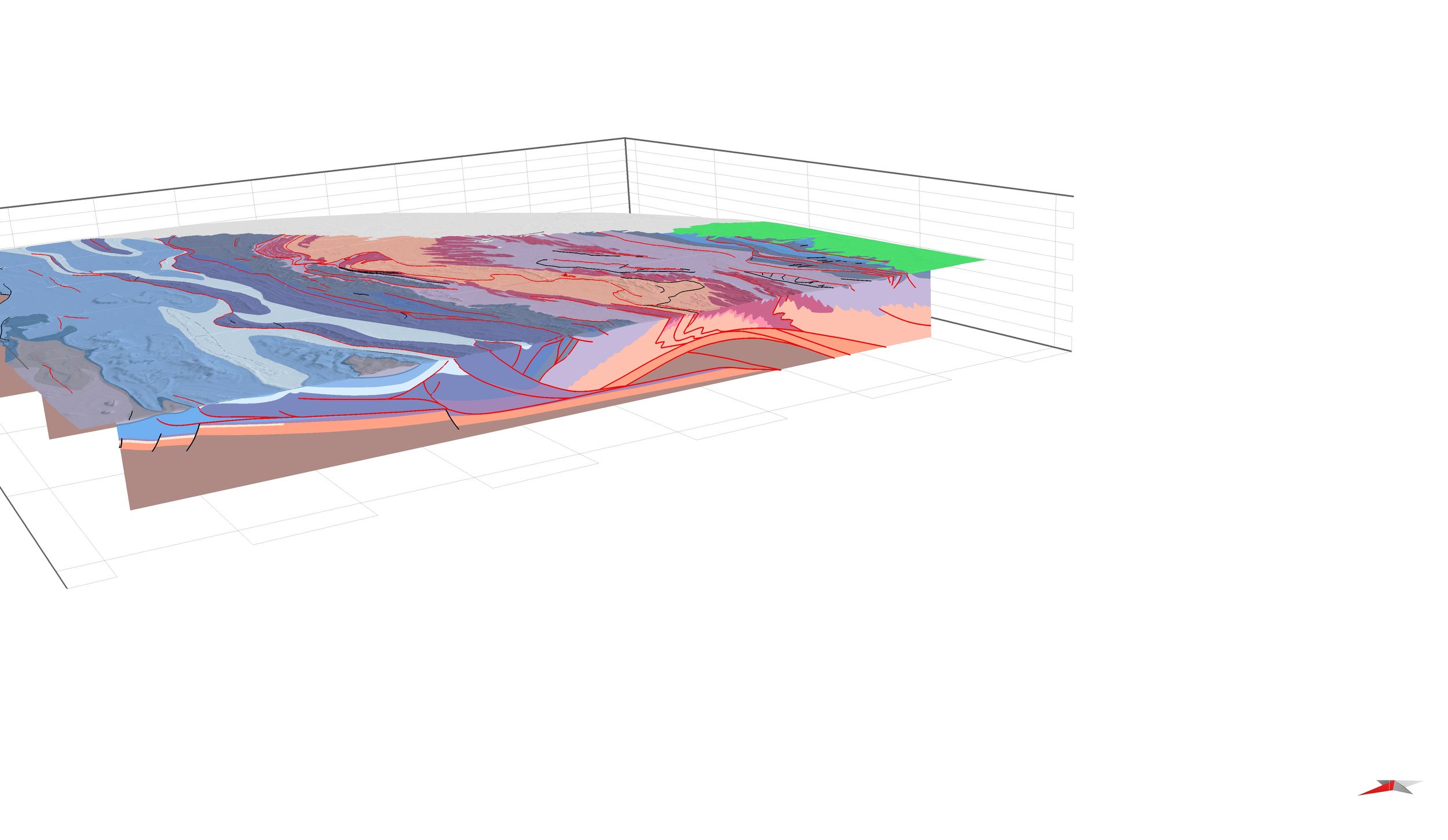
Bringing Arbenz (2008) to life. This 3D model (in progress) was built from a compilation map and 10 regional cross-sections. Several key structural features are labeled in the oblique view to the SE.
The 3D framework model and 2D kinematic model will help understand the distribution and genetic controls on important natural resources (e.g., water, biodiversity, hydrocarbons, critical minerals deposits) and hazards (e.g., earthquakes, landslides, flooding).
Previews shown here are the results of “Phase I”, which involved rendering of an existing compilation into 3D space and analyzing it. The existing model is Arbenz (2008) Plate 2 and associated 2D structural cross sections.
Below are “cutaway” perspectives of the 3D model based on the work of Arbenz (2008)


Phase II
Influence of inherited structure on flexural extension in foreland basin systems: Arkoma Basin and Ozark Dome, USA (in press for Earth Science Reviews)
Below are some highlights from a manuscript focused on 3D modeling in the Arkoma Basin and southern Ozark Dome, covering ~1/2 of the entire foreland basin system

View to the N of 3D model representing the top of the Mississippian Boone Formation. 3D model reveals the complex structural architecture of extensional faults formed in the foreland of the Ouachita Orogeny.

The Arkoma Basin
contains flexural extensional faults that separate the foredeep/forebulge depozones from the wedge-top and Ouachita fold-thrust belt.
These faults accomodate flexure during construction of the orogenic wedge and record the orogenic evolution.
This study focused on the evolution of and underlying controls on these faults,

3D modeling
is performed using state of the art oil industry Move software. Subsurface well tops (ca. 20,000) are available for formations of interest within the Arkoma Basin. Kriging mesh surfaces offset by faults were fit to the well tops of key horizons to assess faulting through time.

Faulted mesh surfaces
Reveal relay ramps and slip gradients. The main, E-W trending faults are segmented by pre-existing basement lineaments/faults related to an older phase of rifting.

The NE-trending lineaments extend SW beneath the thrust belt. The projected lineaments also segment the E-W trending frontal thrust-cored anticlines.

Fault segmentation
patterns discovered from precise outcrop-scale observations (e.g. Peacock and Sanderson, 1994) are repeated at the scale of an entire half-basin (this study).
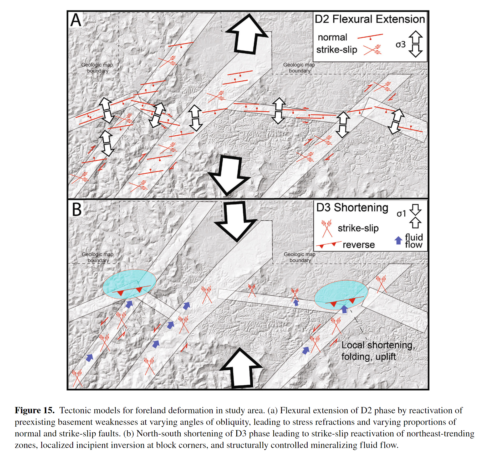
NE-SW trending
structural zones within the Ozark Dome area are thought to be pre-existing weaknesses within the basement, which were reactivated during Late Paleozoic flexural extension. These zones influence MVT deposits and induced seismicity (Hudson and Turner, 2022).
Formation of the fold thrust belt and end-loading on the lithosphere likely drove deep circulation of brine waters. These waters may have mobilized critical minerals near inverted basement faults beneath the Ozark Dome. Hudson and Turner (Tectonics) show with thousands of field structural and kinematic measurements that such faults were reactivated during flexural extension, and that their locations correspond to the locations of MVT Pb-Zn deposits in the Ozark Dome.
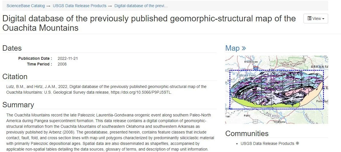
Digital database of Arbenz (2008) map
Whatever it is, the way you tell your story online can make all the difference.
Here is the link to Science Base data release: Digital database of the previously published geomorphic-structural map of the Ouachita Mountains - ScienceBase-Catalog